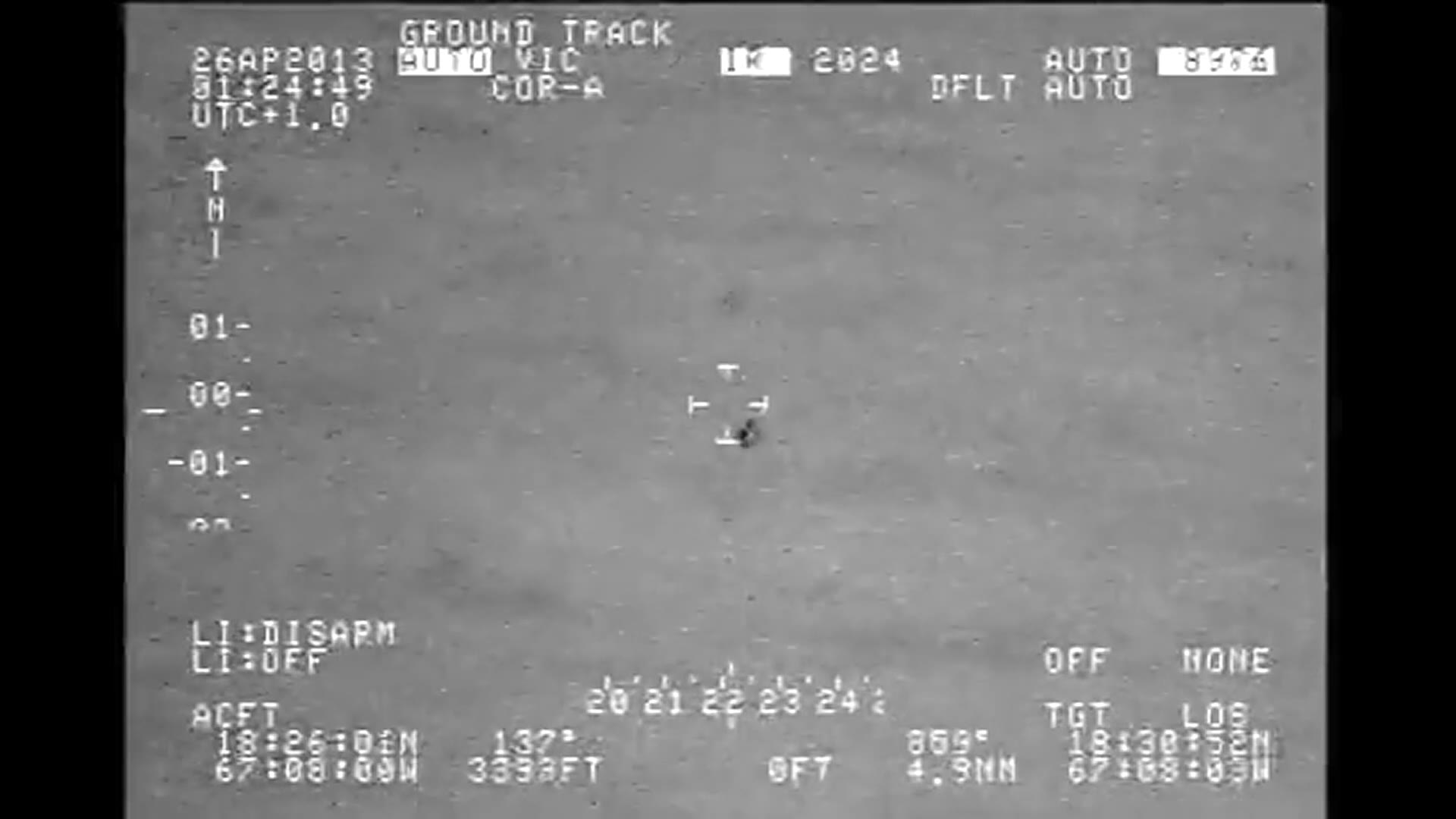
Lead image: Frame at 2:42 from the 2013 U.S. Customs and Border Protection infrared video. DVIDS release.
Watch the small dark shape near the crosshairs. It seems to hurry across the landscape, head for the water, and turn into two shapes. That’s a lot to ask of one dark speck. It’s also the reason the Puerto Rico video is worth watching twice.
A U.S. Customs and Border Protection crew recorded the footage near Rafael Hernández Airport in Aguadilla on April 26, 2013. The official release runs just under four minutes. The apparent split is the moment most people remember. The part that matters just as much is what the aircraft was doing while the camera tracked the shape.
U.S. Customs and Border Protection footage, April 26, 2013, via DVIDS. Watch directly at DVIDS if the player doesn’t load. The appearance of U.S. Department of War (DoW) visual information does not imply or constitute DoW endorsement.
One shape from one angle
The All-domain Anomaly Resolution Office’s report describes two objects moving near each other. In its reconstruction, the objects drifted at about wind speed and stayed over land. The agency assessed with high confidence that the video did not show anomalous speed or flight behavior, but only with moderate confidence that the objects were sky lanterns. Those are two different conclusions.
Try holding two fingers at different distances from your face. Line them up so one hides the other, then move your head sideways. Both come into view. Neither split. It’s an easy way to see how a moving camera can change the apparent number of objects without either object doing anything unusual.

Water presents the same problem. A shape can cross the part of the screen that shows water without being in the water. To tell where it went, you need to know where the sensor was pointed and how far away the shape actually was.
What the critics asked to see
In an April 2025 response, the Scientific Coalition for UAP Studies asked for the reconstructed coordinates, the uncertainty around those positions, and more detail on the radar and cloud information. It also questioned how an image analysis involving a utility pole was done. SCU said AARO acknowledged the questions but was not ready to answer them at the time.
That leaves a concrete question worth arguing about: does the reconstructed path fit the footage, and how far could it be off? The recording gives you the view from the aircraft. The case turns on whether you can place those shapes in the world beyond the screen.
Read next

What AARO’s edited Afghanistan UAP video actually establishes
Another infrared case where the way the footage was recorded and processed changes what you can infer.
Leave a Reply